


KAUAI ESCAPES DIRECT HIT FROM HURRICANE ANA
Hawaii will continue to face some hazards from Ana through early this week, despite escaping a direct hit.
Ana took a path to the south and west of Hawaii over the weekend, nearly paralleling the island chain but was close enough to bring gusty winds, heavy rain, and rough surf.
Ana is expected to weaken slightly as it tracks to the northwest away from the island chain.
Strong upper-level winds, which have kept Ana from strengthening appreciably, are expected to gradually weaken through the middle of the week.
“Beyond Monday, Ana will track in a general northwestward motion through the rest of the week moving away from Hawaii and staying away from other major land masses,” said AccuWeather.com Meteorologist Erik Pindrock.
Bursts of heavy rain and gusty winds between 40 to 50 mph will rotate across Nihau, Kauai, and Oahu through Monday before conditions improve. Any power outages would be very sporadic and isolated. Similarly, any flooding and mudslides will tend to be localized.
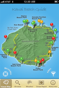
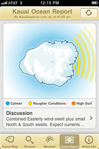
However, seas will remain rough and dangerous for novice boarders, boaters and bathers around much of the islands into early this week
Although this report is about Hurricane Ana, a North shore swell will continue with high surf even after the South shore surf goes down on Monday.
Category : Blog